top of page

North East Winnipeg Historical Society Inc. (2010)

Area Histories
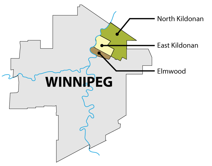
The current City of Winnipeg was created in 1972, with the amalgamation of the City of Winnipeg with twelve other local governments, including North Kildonan and East Kildonan. Elmwood was already part of the City of Winnipeg.

View a larger map from 1969
Walking Tours
-
Brazier Street Tour
-
Elmwood Cemetery 6A Tour
-
Fraser's Grove Sitting Tour
-
Glenelm District (5 stops, 2.5 km)
-
Hazel Dell/The Purple House/The Munroe House (4 stops/1.8 km)
-
Louise Bridge District (5 stops, 1.4 km)
-
Kildonan Drive North (2 stops, 2 km)
-
Kildonan Drive South (5 stops 2.5 km)
-
Nairn Avenue Tour
-
Watt Street North (5 stops, 3.2 km)
-
Watt Street South
Newspaper Articles and Other References
This section consists of newspaper articles, reports, Council Minutes, and other reference material.
Go to the Newspaper Articles page
Historical Maps
To view a variety of historical maps of Winnipeg and Manitoba, go to the
Historical Maps page.
Cemeteries
Elmwood Cemetery: list of interments, map (88 Hespeler Avenue)
St. Mary’s Polish National Cemetery (400 McIvor Avenue)
B’Nai Israel (Children of Israel) Jewish Cemetery (484 Almey Street)
bottom of page